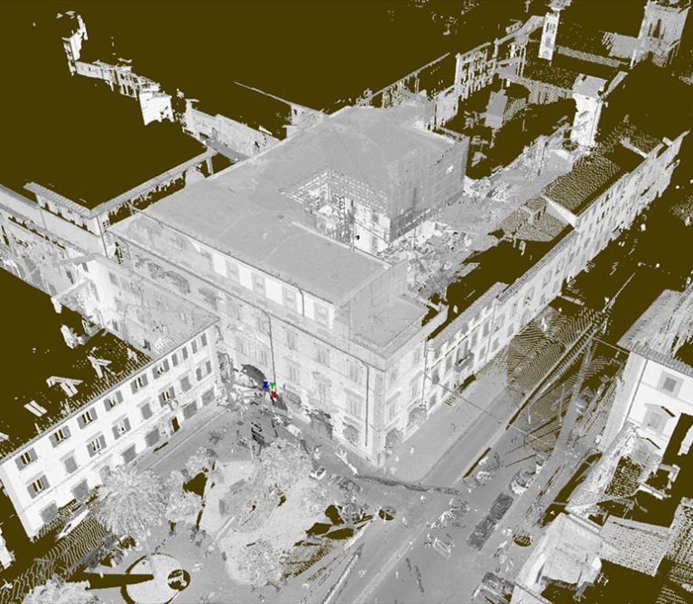
3D Laser Scanner survey – Scan to BIM of the Fire Department of Campobasso
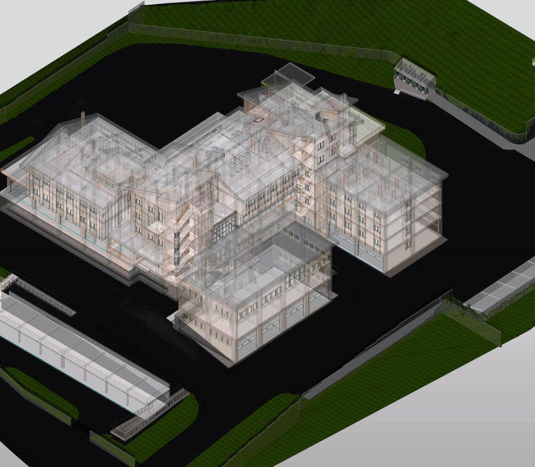
3D Laser scanner survey – Scan to BIM – Avezzano Law Court
Laser scanner survey Gucci Logistics Firenze
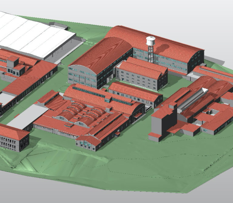
Laser Scanner survey Ex Seves Area – Florence
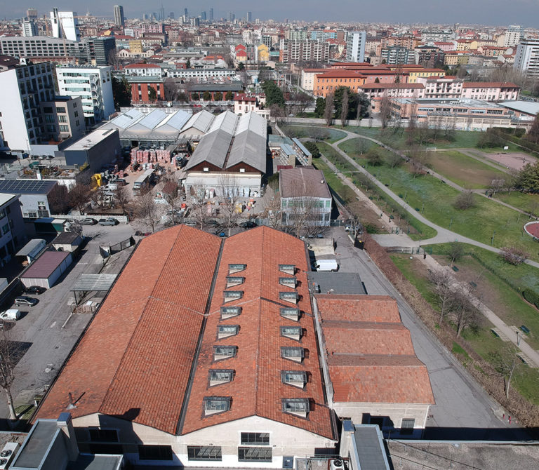
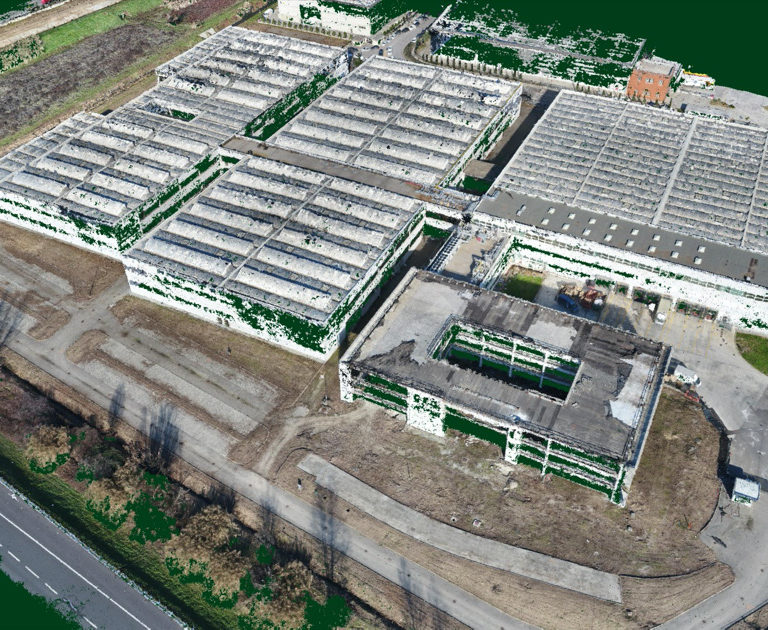
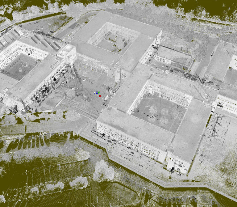
Photogrammetric survey using drone – Milan
Unmanned aerial photogrammetric survey of a production site in Milan
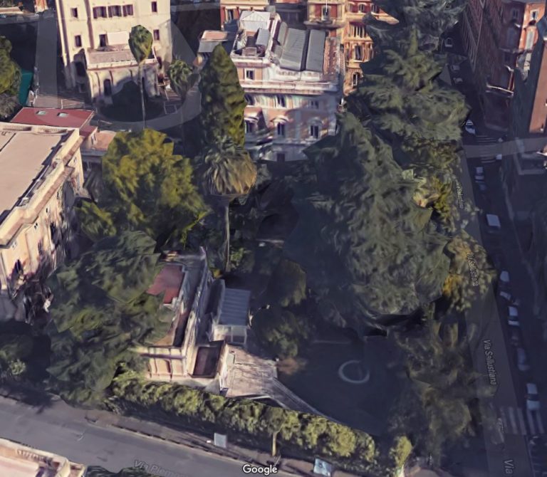
Architectural surveys: Rome – Villini
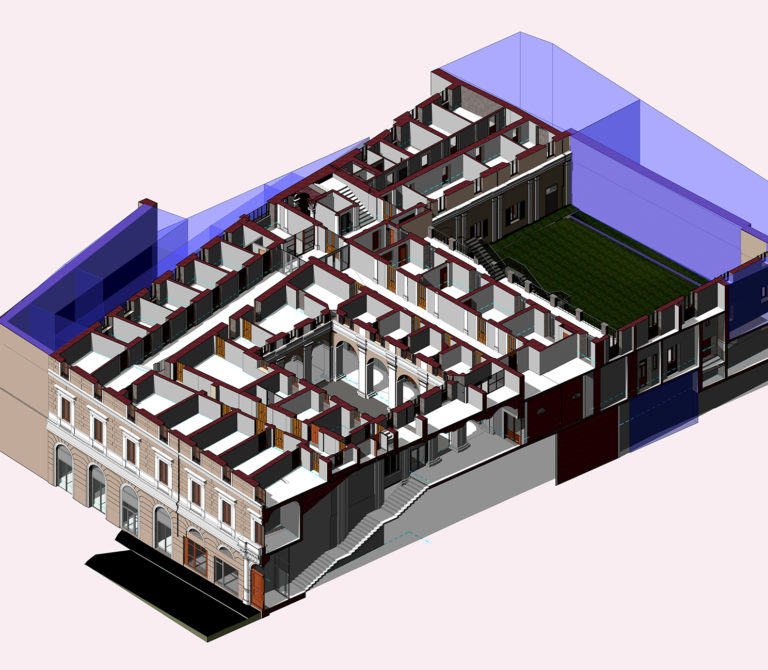
3D Laser Scanner survey of a housing complex in Rome
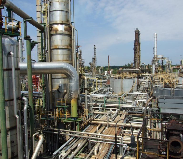
The IES refinery in Mantua
3D Laser Scan of the Mantua refinery (Italy)
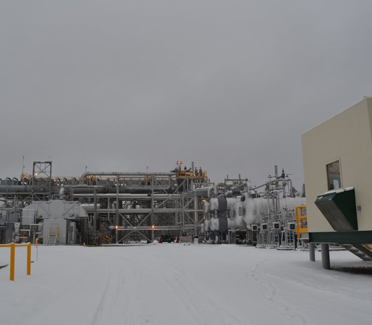
Onshore Surveys
3D Laser Scan of an ONSHORE – OIL & GAS facility
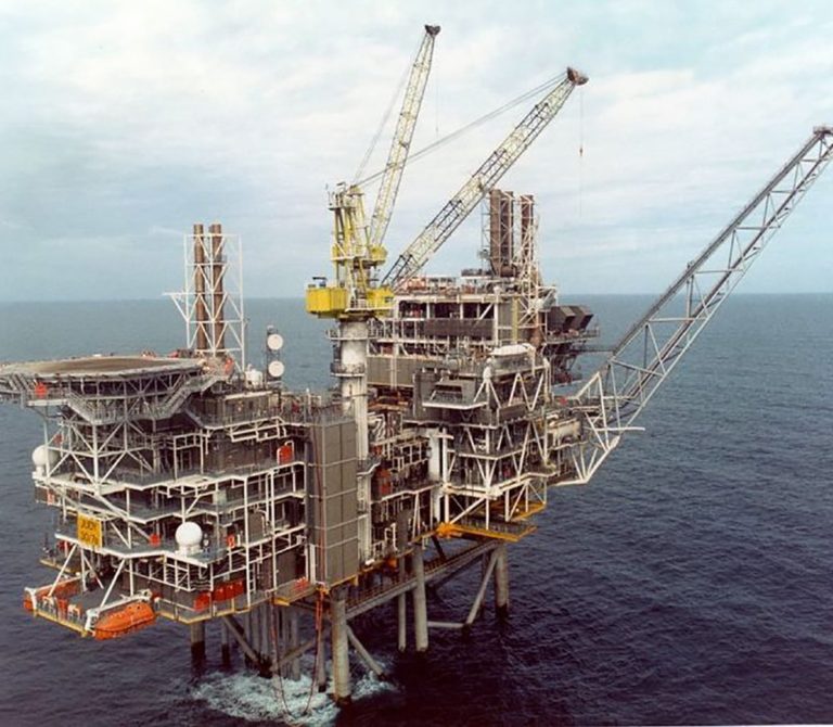
Offshore Surveys
3D Laser Scan of an OFFSHORE – OIL PLATFORM
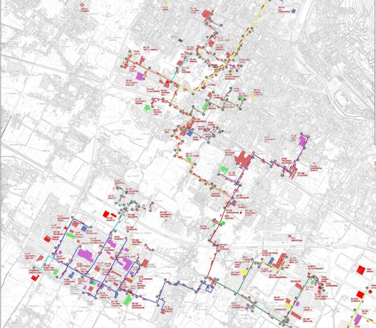
Urban survey of Prato and Montemurlo
3D Laser Scan and data model of the Prato and Montemurlo urban network
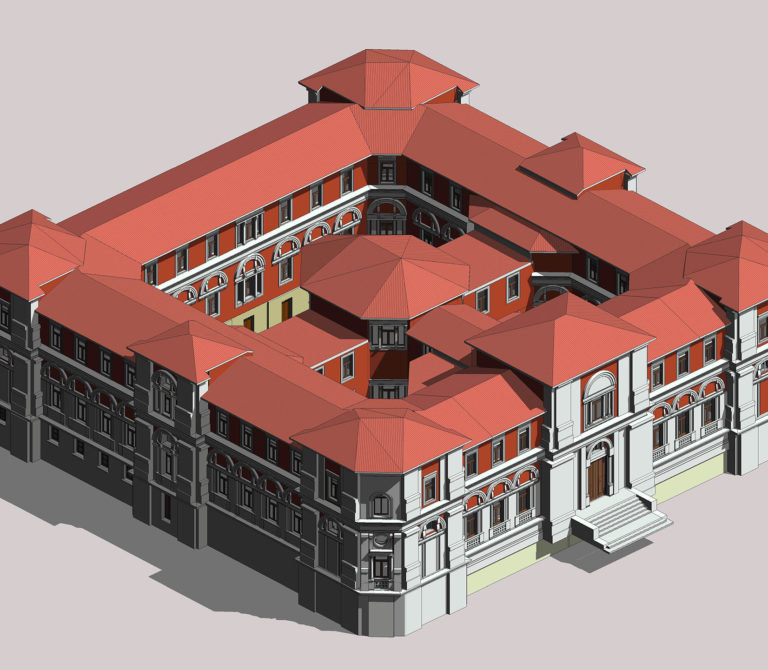
Palazzo Amati Cellesi in Pistoia
3D Laser Scan of the Palazzo Amati Cellesi in Pistoia
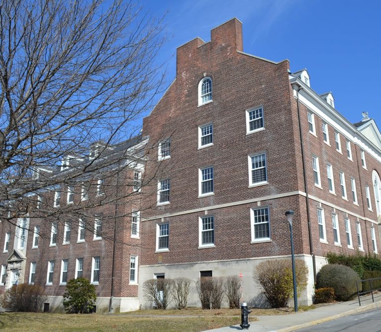
New York – survey of Governors Island
3D Laser Scan of a building located on Governors Island in New York
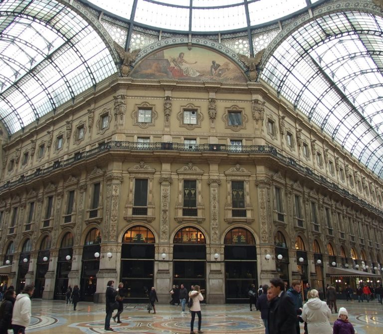
The Galleria Vittorio Emanuele II in Milan
3D Laser Scan of the Galleria Vittorio Emanuele II in Milan
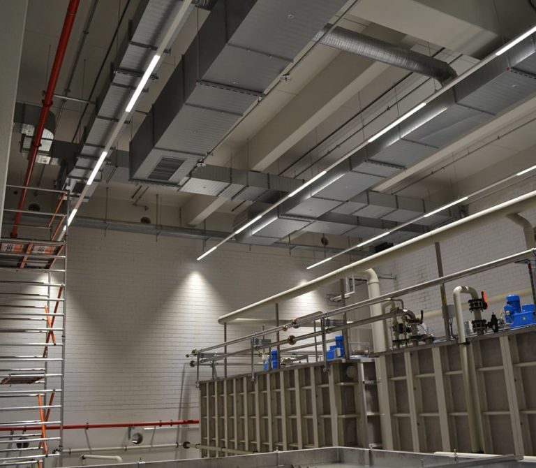
The MAN bodywork painting facility in Germany
3D Laser Scan of a bodywork painting facility at the MAN plant in Munich – Germany
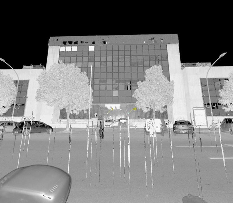
The former Telecom Building in Bologna
3D Laser Scan of the former Telecom Building in Bologna
The former Telecom Building in Rome
3D Laser Scan of the former Telecom Building in Rome
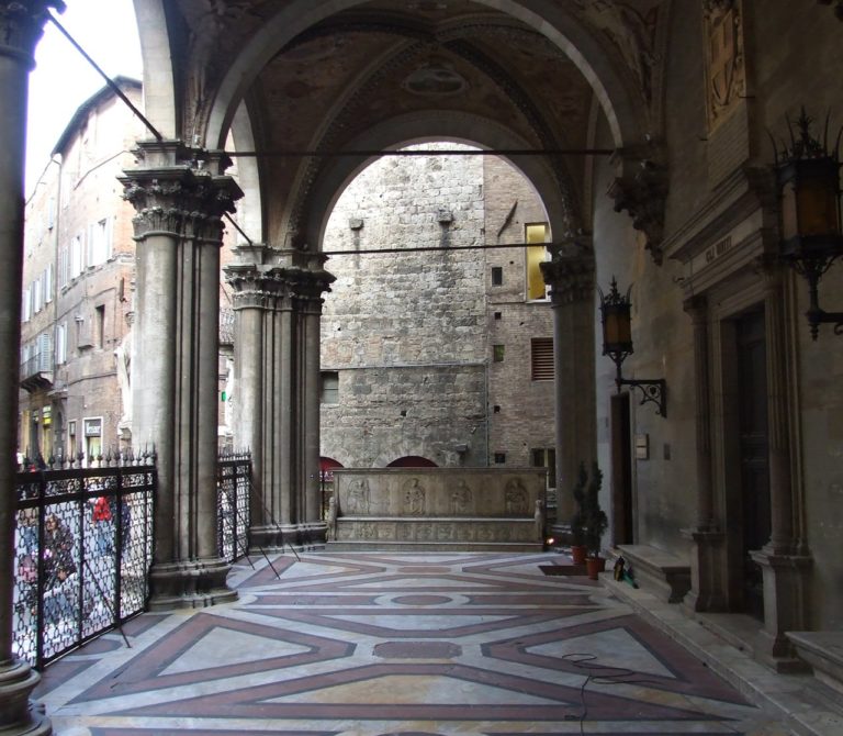
The Santa Maria della Scala Museum Complex – Siena
3D Laser Scan of the Santa Maria della Scala Museum Complex in Siena
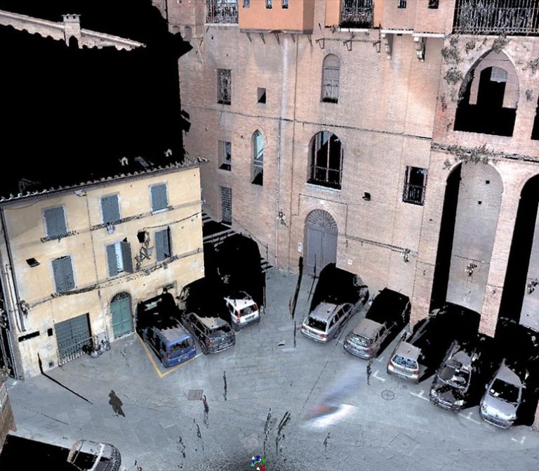
The Santa Maria della Scala Museum Complex – Siena
3D Laser Scan of the Santa Maria della Scala Museum Complex in Siena
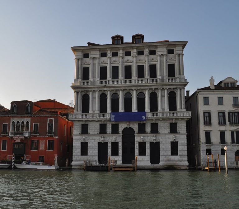
A historic palazzo in Venice
3D Laser Scan of a historic palazzo in Venice